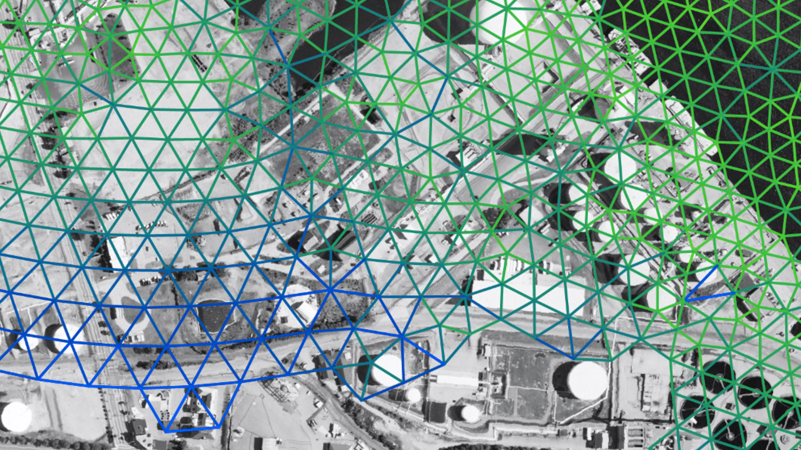
The Rhode Island Coastal Hazards, Analysis, Modeling, and Prediction (RI-CHAMP) leans on UNITY — the UMass-URI HPC cluster located at the MGHPCC - to help keep state officials ahead of strong storms
Reporting from MGHPCC News
With the 2023 hurricane season in full swing, Rhode Island can be thankful for a new storm modeling system that provides state and local emergency management officials with up-to-the-second information on wind strength and flooding to enable real-time decision-making.
The Rhode Island Coastal Hazards, Analysis, Modeling, and Prediction (RI-CHAMP) system, developed by University of Rhode Island oceanographer Isaac Ginis and his team, advances storm model capabilities and creates a real-time hazard and impact prediction system for hurricanes and nor'easters in Southern New England. It became fully operational for the first time this year, encompassing the cascading consequences of extreme weather on critical infrastructure like wastewater treatment facilities, sewer systems, airports, and seaports.
Hurricane Lee, which fortunately for New England ultimately made landfall as a post-tropical depression to the west of Halifax, Nova Scotia, nonetheless brought strong winds and bands of heavy rain to southern New England, however, the event also provided RI-CHAMP with its first opportunity to generate real-time forecasts while Rhode Island was preparing for the storm. "We were able to deliver these forecasts in a timely manner to the Rhode Island Emergency Management Agency thanks to our priority access to MGHPCC’s UNITY computing nodes, secured by the URI Center for Computational Research," said Dr. Isaac Ginis, Professor of Oceanography at URI, who developed the system with funding from the U.S. Department of Homeland Security.
Ginis has a history of developing computer models to predict storm strength. He was one of the first scientists to develop a coupled hurricane-ocean model to more accurately predict the intensity of a storm, a system adopted by the National Weather Service. He is also part of a research team that is studying the impact of sea-level rise when coupled with extreme weather as part of a four-year, $1.5 million grant from the National Oceanic and Atmospheric Administration.
The URI team has been working on the RI-CHAMP modeling system to predict the impact of major storms as they approach land for about eight years. “This is the first system of its kind built in the country,” Ginis said. “We are a pilot project to demonstrate that this system can be developed and implemented.”
“When a hurricane approaches land, we are not only concerned with the strength of the wind, but with flooding–what we call the storm surge produced by hurricanes,” Ginis explained. “We need a special model that simulates what is going to happen in response to hurricane-force winds to predict storm surge.”
One of the most important requirements of the model was to represent the complexity of the Rhode Island coastline, Ginis said. It required developing a computational grid with a high spatial resolution to accurately show predicted hazards from wind and coastal flooding. In some areas, the model has a spatial resolution of 10 meters. In comparison, the National Weather Service’s best model in the New England area has a spatial resolution of 200 meters, he said.
“That allows us to more accurately predict the movement of water in a specific location. That’s key to predicting storm surge,” he said.
With that detail, the modeling system has the ability to calculate hazards to infrastructure in the smallest of areas–such as a generator room or parking lot. Austin Becker, chair of the URI Department of Marine Affairs, and several of his graduate students worked with state and local officials and facility managers to collect data on critical infrastructure. “The RI-CHAMP system provides not only information about storm surge and expected wind speeds, but also about the consequences these hazards may have for Rhode Island’s infrastructure,” Becker explains.
“The URI team collected the data across the state, mostly in the Providence area, about critical facilities,” Ginis said. “We built this data into our prediction system. As we forecast hazards, we can simultaneously predict when a facility will be affected. RI-CHAMP includes a web-based, fully interactive dashboard where emergency managers can see in real-time where the hazards are and what the impact will be on their facilities or communities.”
“As a decision support tool, RI-CHAMP helps emergency managers prepare for storms based on specific, actionable data where we used to rely primarily on instinct and our experience with past storms. The ability to anticipate and prepare for the specific consequences of a given storm forecast is a game changer,” said Sam Adams, a Ph.D. candidate in URI’s Marine Affairs Coastal Resilience Lab who also serves as the University’s full-time emergency management director.
Along with Ginis and Becker, the URI team included Chris Damon in the URI Environmental Data Center, who helped design the system’s interactive dashboard, and Pam Rubinoff, associate coastal manager in the Coastal Resources Center, who led stakeholder engagement. Also, graduate students in URI’s Graduate School of Oceanography and Department of Marine Affairs had an essential role in the development of the system, Ginis said.
RI-CHAMP computations rely on UNITY — the UMass-URI HPC cluster located at the MGHPCC. “I’m so proud of my IT Research Computing team that worked closely with RI-CHAMP scientists to deliver these extremely valuable results on time using computational resources that were built and managed in close partnership with UMass,” said Dr. Gaurav Khanna, Director of Research Computing and the URI Center for Computational Research which oversees URI's involvement in UNITY.